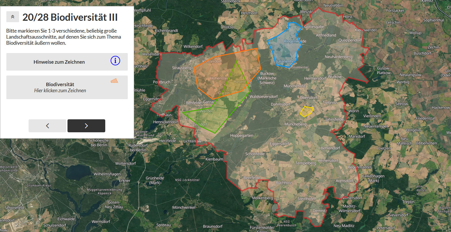
Map your need for ecosystem services in Brandenburg!
As part of the “Status Quo and Demand for Ecosystem Services” work package, a large-scale survey has been started in the districts of Uckermark, Märkisch-Oderland and Ostprignitz-Ruppin. The aim is to determine the needs of different professional groups for erosion control, biodiversity, water, yield and carbon sequestration in soils and plants in different landscape sections. At the same time, we are researching the potential of map-based survey tools – with the software “ Maptionnaire “Online surveys can be designed with a spatial reference, in which respondents can express themselves explicitly about landscape sections of their choice!
Integrated land use concepts require reliable analyzes on the supply and demand side. With the integration of map-based knowledge of local experts, valuable information about the regions in which sustainable landscape innovations are to be created can be recorded.